The Moon is already on Google Maps—did Artemis II really tell us anything new?
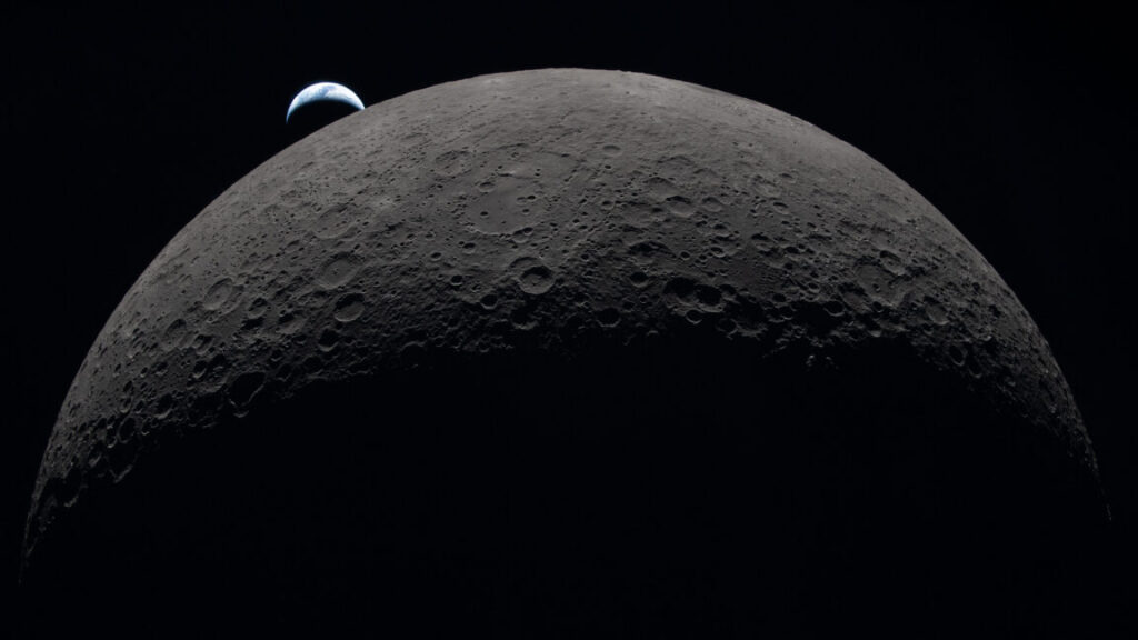
Text settings Story text Size Small Standard Large Width * Standard Wide Links Standard Orange * Subscribers only Learn more Minimize to nav The data pipeline from NASA’s Artemis II mission opened to full blast a few hours after looping behind the far side of the Moon on Monday night, when the Orion spacecraft established a laser communications link with a receiving station back on Earth. A cache of high-resolution images began streaming down through this connection. NASA released the first batch to the public Tuesday. Most of the images were taken by the four Artemis II astronauts using handheld Nikon cameras fitted with wide-angle and telephoto lenses. They also had iPhones to capture views out the windows of their Orion Moon ship,…